Tracking Panama Canal water levels with Sentinel-1 SAR
AIS density map showing vessel paths to and from Panama Canal at the image centre. © VesselFinder
This post is part of the “Measuring from Orbit“ series, where we turn satellite data into measurable signals of how the world is changing.
The Panama canal is one of the most important chokepoints for global trade in addition to being a fascinating piece of maritime infrastructure. Disruptions in the operation are felt wide.
The canal relies on the annual wet season rainfall to fill the Gatún lake and operate the locks. To understand that dynamic, today we:
Create a SAR-based system to track water levels at the canal
Analyse what led to the 2023 drought
Discuss future projections
1. Creating Lake Gatún water level proxy
As far as Orbital Vantage experiments go, this was smooth. I’m getting better but this was also an easier exercise. My simple thinking was: Lake Gatún water level correlates with surface area, which we can calculate from SAR data. To orient us, below is an image of the Panama Canal and the lake. I’ve heard many are surprised that the transit from Atlantic to Pacific is actually West-East oriented.
Panama Canal and Lake Gatún. Contains modified Copernicus Sentinel-1 data (2026)
The workflow to understand Lake Gatún water level was:
Create a SAR-based water mask layer in GEE
Find known Gatún Lake low & high points (Drought of 2023 and Current high level)
Find a place where the SAR-analysis picks-up the high-low changes
Run historical analysis of water area to validate
Everything else was easy, but finding an area where surface area reliably correlates along the low-high spectrum of water level took ten tries.
Instead of capturing the entire lake, I tried a small cove that reacts extremely strongly to water level changes, but the small-ish area brought in other sensitivities that made it a poor proxy. I next tried to capture a larger area with many coves (like the one below), which was quite close to reality but the large coastline compared to surface area meant it became too sensitive to vegetation changes at the waterline.
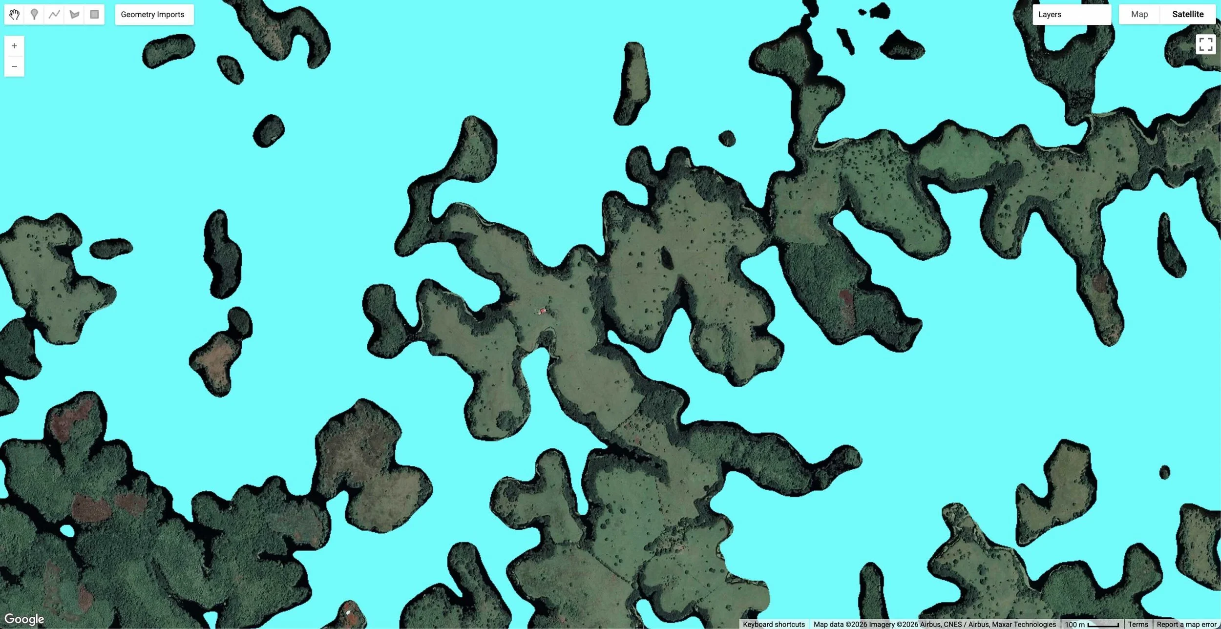
Example water mask layer attempt with a more complex area of the lake. Deforestation is clear.
On a hunch, I tried the area below with a simple coastline without too many complexities. It is only ~1.6km2 but produced the most consistent results. Though later, I lowered sensitivity thresholds and the script started producing good results elsewhere too. Should have done that immediately.
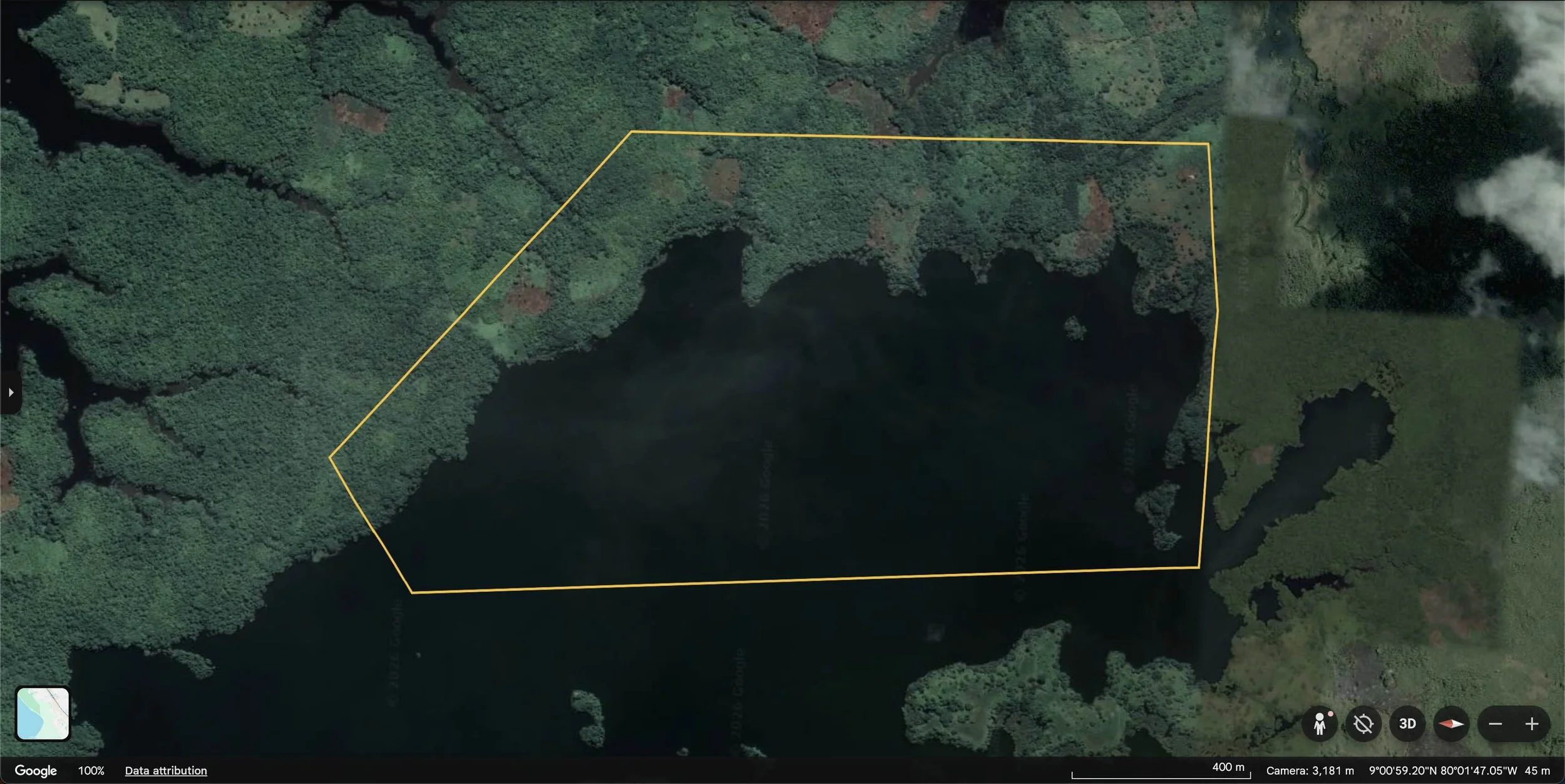
A more well-behaved area for the water mask.
See below data the script produced for 2022-2026 and for comparison the official Lake Gatún water levels below it. It’s not perfect, but as a 30 minute exercise to create a satellite proxy to track water levels, surprisingly good. The data comparison shows it most importantly captures the droughts, but struggles to separate changes near the high-water mark. For canal operations, this is less important. The next step would be to convert the lake area into an elevation estimate.
SAR-based water level proxy in Lake Gatún clearly capturing the 2023-2024 drought.
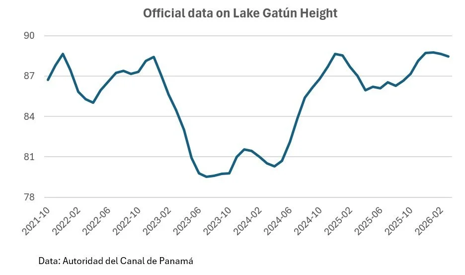
Lake Gatún water levels in feet.
2. What caused the 2023 drought?
The Panama Canal spends a lot of freshwater to operate the canal locks, so it is extra sensitive to water level changes, and water levels can get low quickly. This was the case in 2023 with one of the worst recorded droughts in history for Panama resulting in 30% reduction in vessel transits.
It wasn’t the end result of a prolonged drought of many years or a completely dry year, but one wet season with an estimated 8% less rainfall than normal (Source: World Weather Attribution). Small difference, big impact.
Below is the precipitation anomaly for roughly the wet season in 2023, when the drought started. As we can see, there is clear brown area over Panama indicating rainfall patterns were notably lower compared to long-term average.
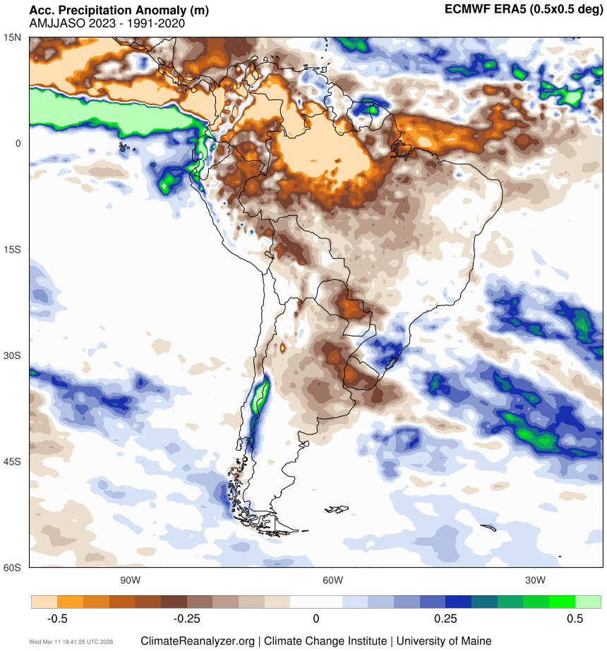
2023 rainfall anomalies driven by El Niño, with copper and brown indicating a drier year.
Most countries have dry spells, but the proximity to the heart of El Niño puts Panama at higher risk. If you don’t know what El Niño is, here is an executive summary. The sea temperature in the Eastern Pacific goes up and down roughly every 4-7 years. The warm periods are known as El Niño, the cooler ones La Niña. This is perfectly normal, but El Niño releases massive amounts of heat to the atmosphere that throws off weather systems around the world, affecting winds and rainfall patterns.
Below is an image that shows the anomaly in sea surface temperatures in 2023, clearly showing the hot El Niño in red.
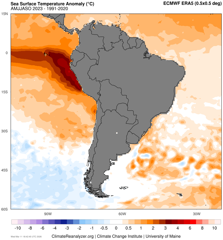
Sea surface temperature anomaly data shows El Niño off the coast of Peru and Ecuador.
In short: El Niño conditions every 4-7 bring increased risk of drought to Panama. If this is normal, why did it catch the Panama Canal off guard?
3. Future: More droughts, more mitigation
The El Niño of 2023-2024 may not have been record strong, but still created a record drought in Panama. I remember from high school geography lessons that climate change is expected to increase the frequency and intensity of El Niño events.
It’s one thing to hear that at school 20 years ago, another to see what the data says today. Below is the 100-year record of sea surface temperature anomalies in the key El Niño region. Red peaks correlate with El Niño, blue with La Niña.
Data shows increasing El Niño strength and frequency.
I don’t need a degree in statistics or climatology to say there is more red on the right hand side. Not only are the red peaks more frequent, but also longer in duration and more intensive. In essence, El Niño -driven droughts are an increasing risk to Panama Canal operations, unless they do something about it.
After 2023-2024, The Canal authority announced a $1.6bn plan to improve drought transit capacity with a new reservoir and more efficient water lock cycling. The lock upgrades are operating this year, but the new Indio reservoir only starts construction in 2027 and takes multiple years to complete. Together, they will give a lot of buffer against future droughts, but the next 6 years will see at least one El Niño before those measures are in place.
In addition, other future mitigation measures remain if the above are not sufficient. The debate and economics get interesting and we might revisit those in a separate post.
Conclusion
All infrastructure is vulnerable to environmental changes, not least climate change. Yet in the case of globally critical infrastructure is involved, money is typically not a problem. Whether the new measures for Panama are enough for the coming decades remains to be seen, but with tools like our SAR water level monitoring, we now have a way to track the situation in near-real time.
See you,
Orbital Vantage