Deforestation seen with three velocities in Europe, New Zealand and Amazon
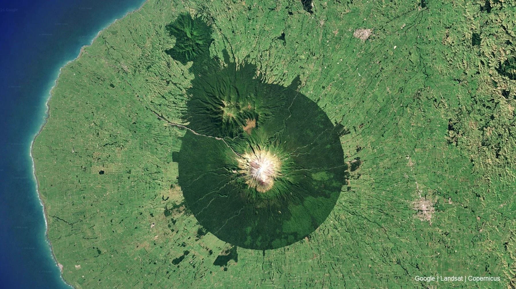
Mount Taranaki, New Zealand.
In the cover picture, Mount Taranaki in New Zealand stands from orbit with its near-perfect green circle around it. Everything outside that circle is farmland. Inside, dense native forest. While striking visually, it is also a visible boundary between what was and what replaced it.
Taranaki inspired me for today’s topic: A brief view to deforestation in Europe, Taranaki and Amazon. Across the three regions, the story is the same but speeds are different: Millennia, Century, and Decades, respectively.
1. Europe - Deforestation over thousands of years
From orbit, Europe does not immediately look like a deforestation story.
Europe is positioning itself as the leader in sustainability and with good reasons, but it has its challenges, sustainable land use being one of them.
See below a mosaic image of Europe. Virtually everything lighter shade is agriculture, the few dark spots are remaining forests, typically protected as national parks and quite often coinciding with elevated terrain that is poorer for agriculture – in other words gorgeous and diverse but also politically some of the least controversial area to protect.
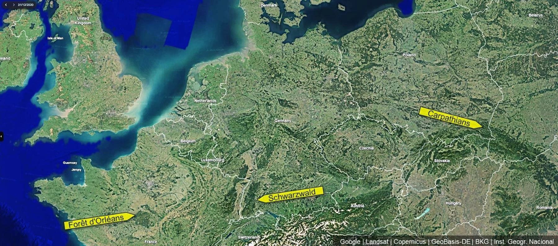
Europe seen from above, with darker spots revealing remaining forests such as Schawarzwald.
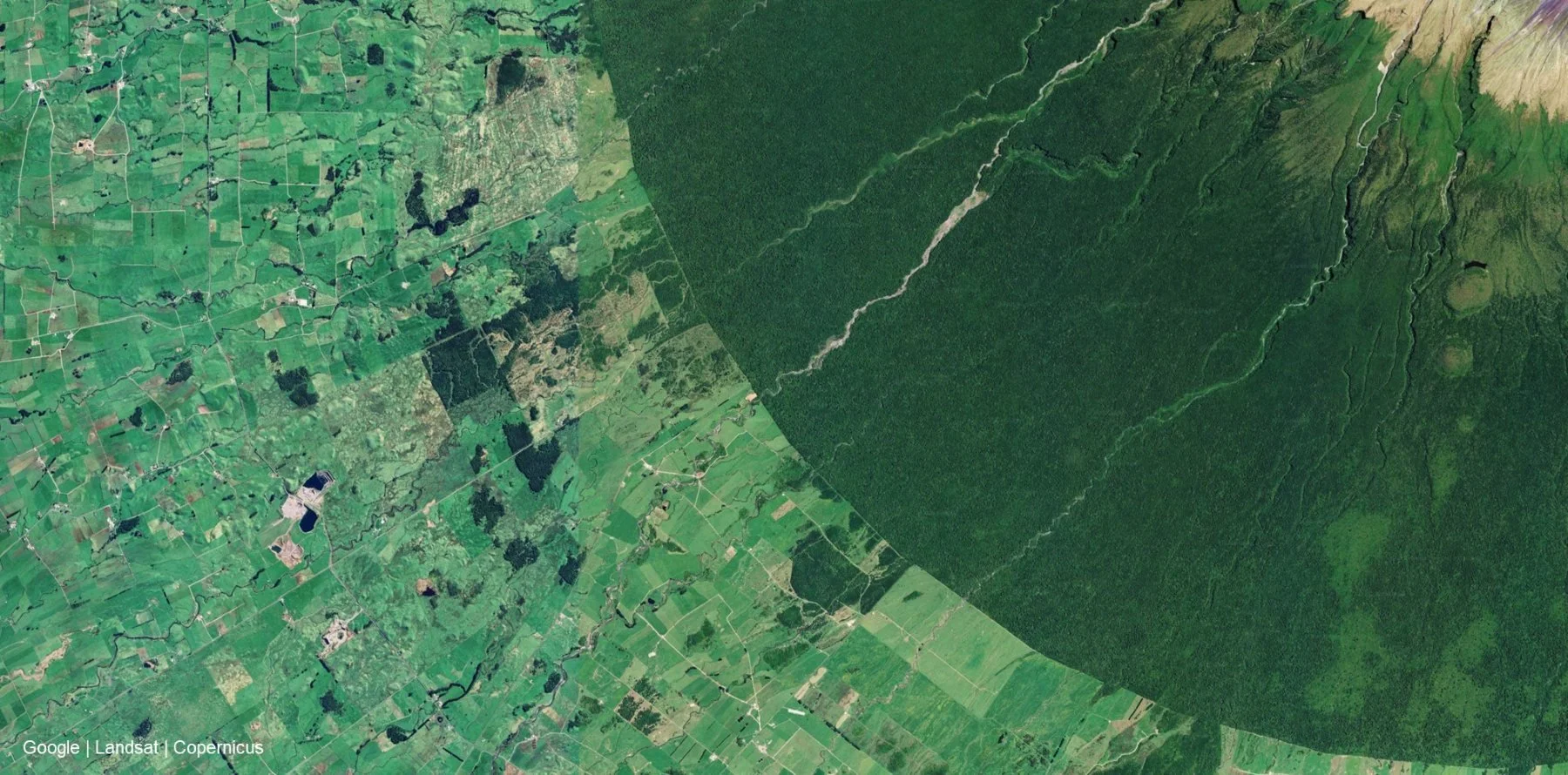
Zoom almost anywhere in Europe and an engineered landscape of farmland like below is revealed.
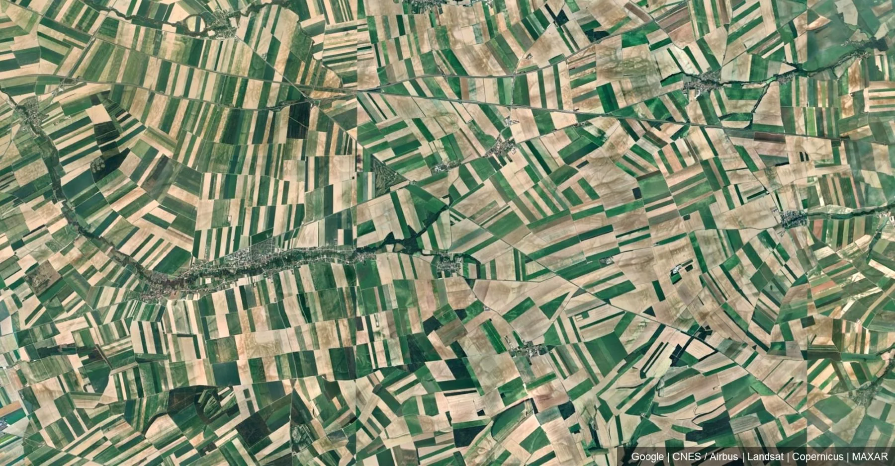
Farmlands in France.
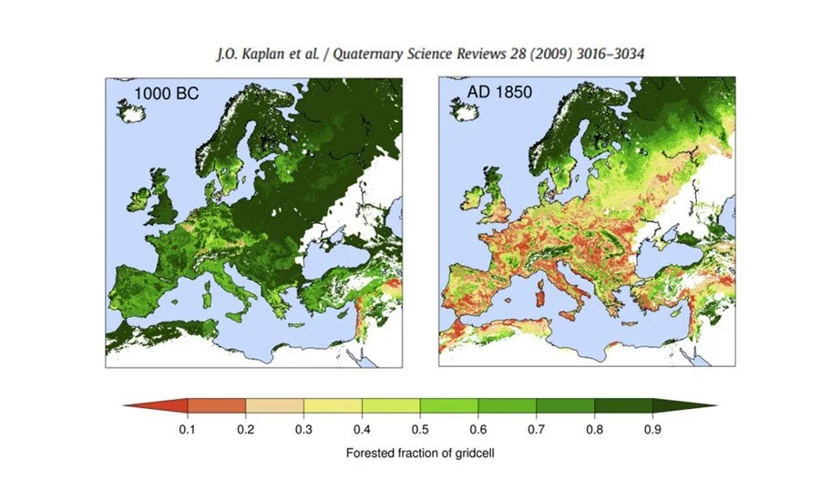
Europe has looked like this for a long time, so what we see is not deforestation but its end-state: Farmland and countryside as we know it. Our baseline. A study by Kaplan et al. (2009) looked at deforestation in Europe and found that over the last 3000 years, the continent has been very effectively converted from forests to agriculture already before 1900s.
In other words, there are few forests left to cut. The agricultural landscape in Europe feels natural largely because it has been there for centuries already and doesn’t lend itself to present-day discussion around deforestation. But the problem is real.
2. New Zealand - Deforestation over a hundred years
New Zealand’s nature is gorgeous, but the ~30 million sheep and cows together need to go somewhere and they need food too.
Before European colonization, New Zealand was largely covered by thick temperate forests. European settlement led to importing agricultural practices and the European landscape. Below is an image of New Zealand’s North Island. Much like Europe, the light areas are agriculture and zooming in reveals farmlands.
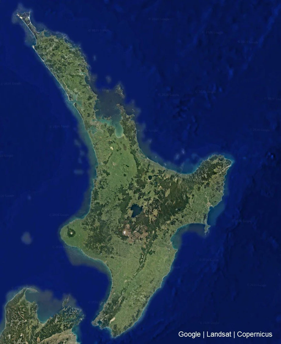
New Zealand North Island. Mount Taranaki visible on west coast as the green circle with white centre.
Mount Taranaki compresses this dynamic into a single image. Inside the 10km boundary, a remnant of the pre-agricultural landscape. Outside, the fully converted farmland.
The clear boundary between protected forest and farmland.
New Zealand’s deforestation story is like Europe’s, but compressed: It is estimated 40-50% of New Zealand’s forests have been lost just in the last hundred years. The Taranaki reserve is 150 years old, but it is telling that its main reason was preservation of timber (and water) as a resource, though natural beauty and wildlife were also mentioned in the charter as described by the NZ government.
Despite the above, nowhere on Earth have I personally encountered such nation-wide respect for nature and present-day sentiment towards preservation as in New Zealand, with continuous attempts to backtrack on some of the historical mistakes like introduction of invasive species.
3. Amazon - Deforestation over decades
Amazon is the infamous poster-boy for deforestation. That was a key worry planted to my mind in high school geography classes and it also makes sense: From a global perspective, we should conserve the forests that are still left.
From a Brazilian perspective, calls for protection coming from Europeans can sound like hypocrisy. In Europe, the question of deforestation has largely disappeared, because the process itself has. But from orbit, it does not look like a different process, only a different point in time on the same journey.
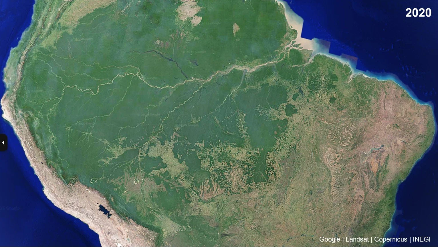
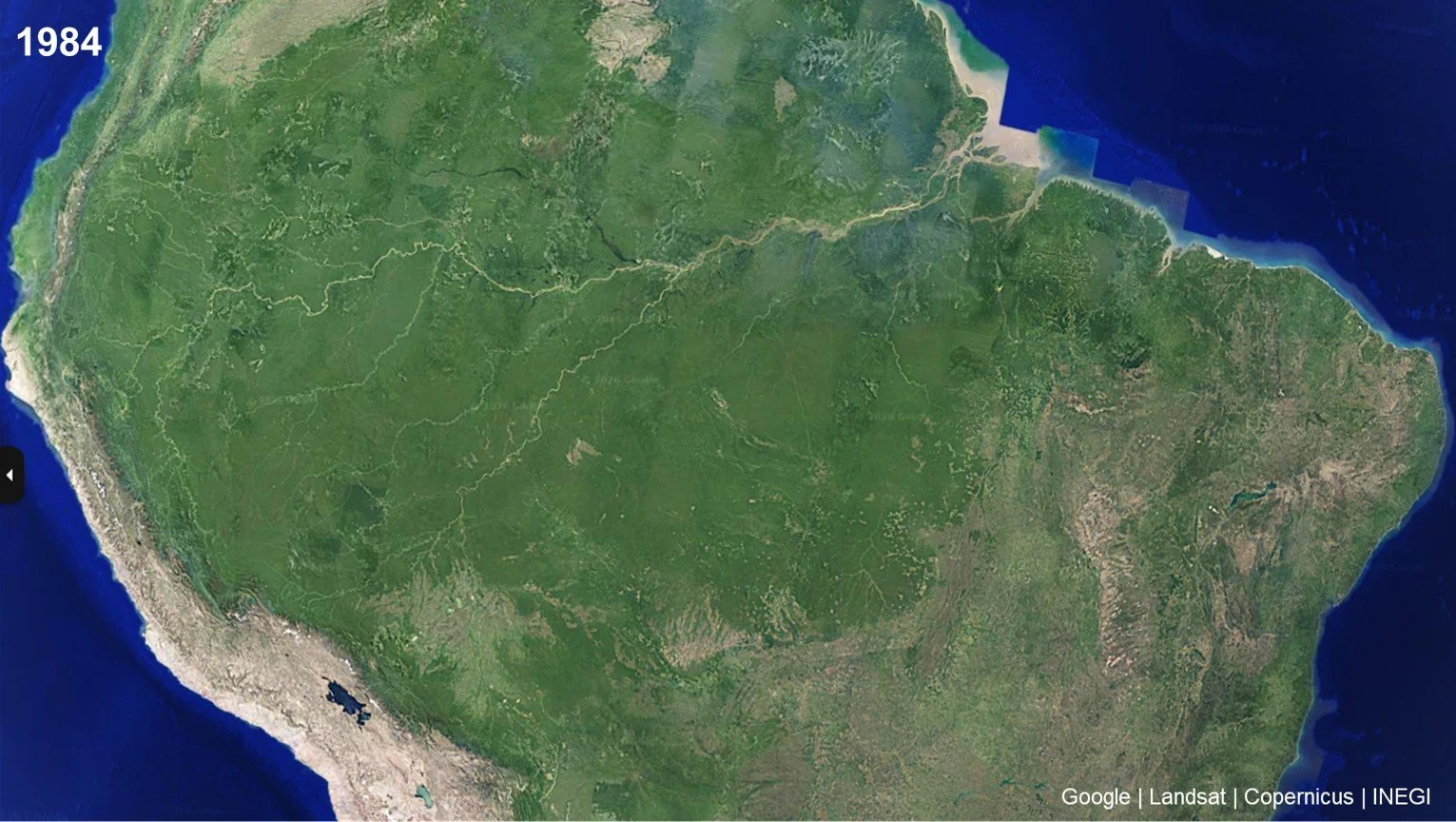
Accordingly, unlike Europe’s and Mount Taranaki’s present state, Amazon is a change still clearly seen from orbit. Use the below slider image to see the difference between 1984 and 2020. In just 35 years, the contrast is dramatic. Moreover, the absolute scale is staggering. It is estimated 20% of Amazon’s forests have been lost in the last 50 years.
As a side-note, you can also see the shallow Lake Poopo in Bolivia (centre left, close to bottom) drying up and disappearing in the image - a very recent change.
The rapid deforestation shows in various patterns emerging in the jungle. Below a close-up of a more recent, fishbone pattern near Porto Velho spanning 60km horisontally.
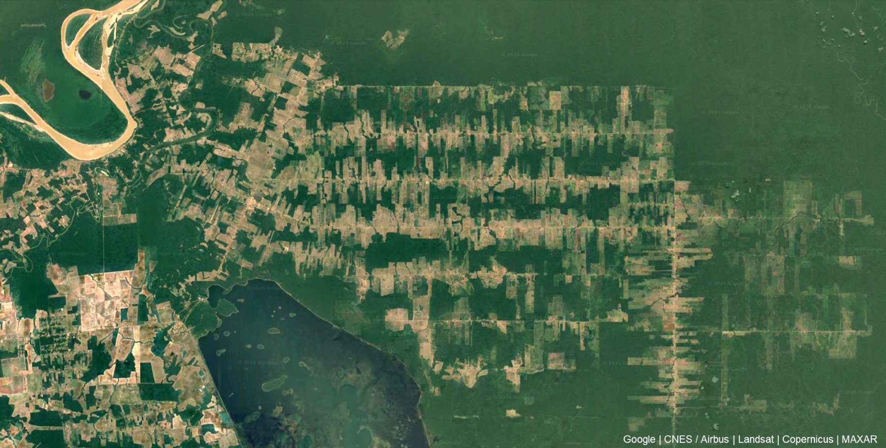
Deforestation pattern near Porto Velho. The structure in the middle is more than 60km wide.
4. Why it matters
It’s difficult to look at the Amazon and not see destruction and want to avoid it.
But from orbit, it is clear Europe and New Zealand are not fundamentally different systems - they are simply later-stage versions of the same process. Reversing historical deforestation is easier said than done and at best takes a long time. Brazil’s deforestation feels different because:
It is ongoing, fast and visible
Happens in a time when the world cares about it
Conclusion
Mount Taranaki’s perfect green circle is not just a visual curiosity, but a visible boundary between two states of the same system: A forested past and an agricultural present.
Europe shows the end state: The boundary has long since dissolved into a landscape that now feels natural. Taranaki in New Zealand shows before and after, side-by-side. Amazon shows the transition process still unfolding within a human lifetime.
Across all three regions, the direction is the same and only the speed and our perspective on it differs.
See you,
Orbital Vantage